
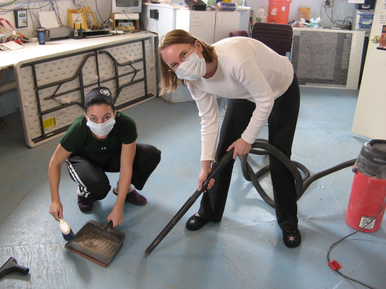
Carla and Kiri cleaning the Hab floor

Luis cleaning the stovetop
Mike, who had been up until the wee hours collecting data with the newly operational radio telescope, retired to his stateroom ensconced in his headphones to listen to the buzz of the night sky, based on recordings collected while the crew slept. Apparently this was sufficiently sleep-inducing that he succumbed to a nap. Actually, we’d all had something of a late night because we decided to stay up until midnight so as to transfer some large files (e.g., download printer drivers and upload movies to YouTube!). Our bandwidth from 5 a.m. to midnight is severely restricted, so the only practical way to do these tasks is to wait for that midnight to 5 a.m. window. To pass the time until midnight, we played several games of Guesstures, which is a variant on charades that we found to be quite entertaining! Carla emerged as a real champion of portraying a variety of characters and concepts with lightning speed. Mike is feeling inadequate and is intent on a rematch. Luis complained that the stress was killing him, so we strapped Brian’s heartrate monitor on him and found that sure enough, his heartrate would go from about 90 (when guessing) up to about 160 (when portraying concepts and trying to get his teammates to guess!).
It was a slow day in Internet-land today. An unattended download after our late-night session did not complete by 5 a.m. (and yes, we know better!). Therefore, around 6 a.m., we’d apparently consumed our entire bandwidth for the day and our access was throttled back (to a total allocation of about 3 kbps—aie!). This was excruciating for all involved. I found it particularly painful because I’d so hoped to use this slow, indoor day to make real progress on my actual research project: automatically associating geotags with images that don’t otherwise have GPS coordinates associated with them. I spent most of the day simply identifying which pieces of software I lacked and, because of the bandwidth restriction, could not download. Prior to the mission, I’d planned to do my analysis in Matlab, and had downloaded several packages that I would use to analyze the images with. But even on good net days here at the Hab, I can’t maintain a good enough connection to the Matlab license server to make that work at all. So I decided to switch over to Python, which I can run independently on my computer, without net access. Except that I then also needed to install new packages for the same analysis goals, in Python rather than Matlab. I’ve made some progress, but not nearly what I’d hoped for!
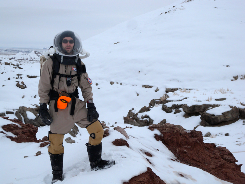
Brian near Radio Ridge Road
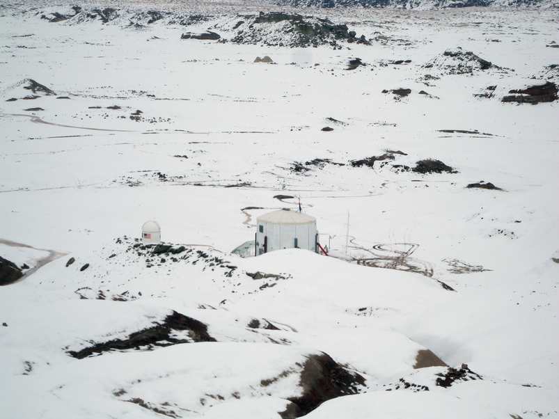
The Hab as seen from Radio Ridge
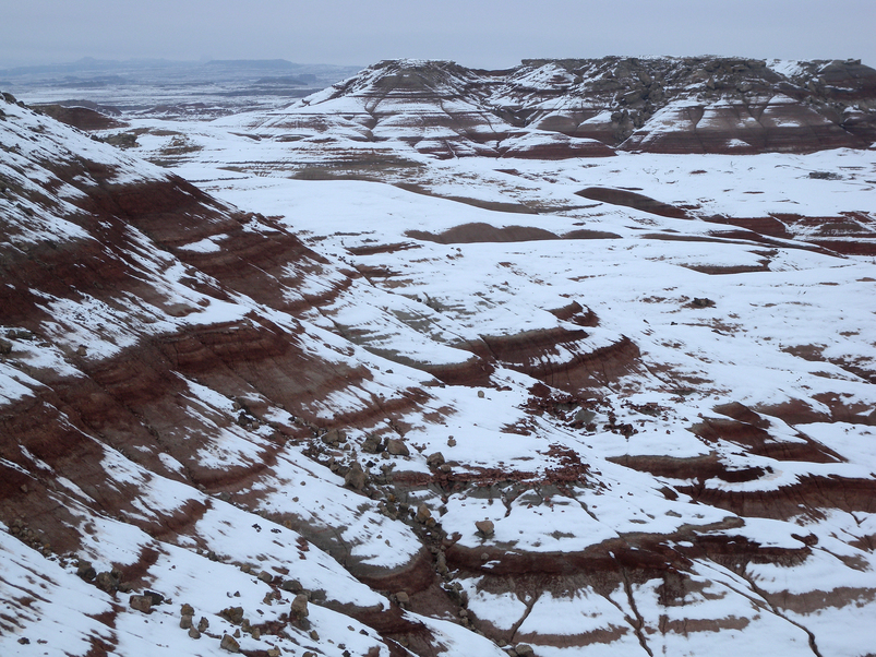
The Turtle Hills covered in snow
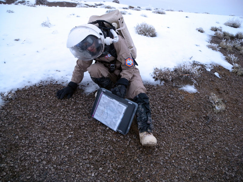
Luis investigating the Devil's Toenails (fossil oysters)
Originally, we had planned to hold a third exercise session today, but after the hours of indoor cleaning, and outdoor EVA activity, we just didn’t have the energy (and likely had gotten a lot of exertion already).
Darrel and Carla cooked tonight, and it is our first experiment with the tinned corned beef, which I think most of us were apprehensive about. However, with a special BBQ sauce Darrel concocted, the pan-fried beef was actually quite tasty! Our meal was rounded out with potatoes au gratin and some peas and cauliflower—and for dessert, Carla had magically pulled together a pumpkin-spice cake with raisins. We’re still not sure how she is managing these feats of wonder, baking amazing desserts with no flour, no eggs, no milk, and barely any sugar. Yet everything is absolutely, mouth-wateringly delicious! Wow, Carla!
As I sign off, Luis is engaged in the unenviable chore of cleaning out that critical breadmaker pan. We are all exceedingly grateful.
Hello Crew 89
First I would like to say I absolutely love the photo/eva routes page! Very contextual! I am a veteran of both MDRS/FMARS and have been wanting a system just like this! This page will help me with both geo and fossil mapping the area!
I do have one question: Is it possible to integrate into the images the direction (cardinal) the images where taken? I am thinking like a remote science team member back on earth.
I also noticed that some of your Gryphaea samples look like they might have some bio-erosion (drill holes)…am I correct?
Stacy
PS Sorry Brian that I never got back to you about the FMARS patch but I had some family issues.
Hi Stacy (Skylar, I presume),
I believe my GPS camera does record the direction the camera was pointing when the photo was taken. Kiri’s auto geolocation photo study is picking apart the metadata in the image files, so if that information is there, we’ll try to pull it out and find a way to display it.
Can you please describe further what you spotted in the Gryphaea samples? We’re not paleo experts here and aren’t sure what drill holes you saw.
No worries about the patch, although if you do ever find the file, please send it my way.
Thanks,
Brian
I don’t think I’ve ever seen delicious and Velveeta in a sentence where the writer wasn’t being ironic! 🙂
Regarding Matlab – their application uses FLEXnet licensing, which supports a “pack and go” construct for concurrent licenses. In other words, you should be able to connect to the network, check out a license for, say, 2 weeks (or whatever the license administrator has configured), then not connect back until time’s up. Alternatively, if you have any rapport with the Mathworks rep, they can get you an extended demo license.
Jim, that’s a great point. We do have “travel” licenses, but they don’t provide access to any toolboxes. I’d be needing the Image Processing Toolbox. But so far it’s looking like I can use the Python Imaging Library instead. We’ll see!
Hi Brian
Yup, Stacy Sklar, drill holes are holes within the shell usually right thru the shell. I am at work right now so the best example I have is at the following url (located near the edge of the hammer):
http://desert.marssociety.org/media/mdrs/fs06/images/crew59/c59d13geo03.jpg
If you need more info let me know and I will take a better image at home and send it to you.
Also, did you see any Gryphaea on Mt. Olympus? There are usually embedded within the green conglomerate unit of the Dakota.
Will keep an eye out for the FMARS patch!
I have a suggestion for your bandwidth woes. I’ve noticed that your webcams run all night, updating through the dark hours with new shots of darkness. Although my preferred hours are all vampiric (and I occasionally check in with high hopes of seeing someone making a late night hot chocolate run) I think the bandwidth might be better saved for your other activities? Could you put the webcams on schedules and black them out to help save a bit?
(From Kiri, as Admin)
That’s a great idea, Wendy — I’d love to configure the webcams to be on such a schedule (with permission from the powers that be 🙂 ). I haven’t seen a scheduling option on the software that operates them so far. We could of course manually disable them at night (again with permission…).
However, the main constraint for us isn’t upload bandwidth (the webcams upload a picture every 3 minutes) but rather download bandwidth. That’s where we run the risk of exceeding our 425 MB/24 hours limit and going into the throttled-mode (which lasts 24 hours). We do have unlimited (though not super-fast) downloads from midnight to 5 a.m. Last night I had a critical fink update/compilation going and had to set an alarm for 5 a.m. so I could wake up and make sure my computer wasn’t still downloading anything at that point.
Stacy, we didn’t notice any Gryphaea on Olympus Mons, but the snow cover makes it difficult to do a thorough survey. We’ll let you know if/when we see more!
My only experience with webcam software is Evocam, which is Mac only. It has a built in scheduling ability, very simple. If your webcams aren’t on a Mac, I’m happy to help you search for a different option with my less limited bandwidth. That’s what you’d do on Mars, right? Send your ‘lackeys’ back on Earth to research something for you!
If it’s not worth the effort, I won’t pursue it. If you’re interested, though, I’m happy to check it out. I wouldn’t mind being an Earthbound lackey!
[…] our ascent to the top of the ridge, we snapped a few photos and video footage. I had been here on EVA 13 just four days ago, and in that time the snow cover had thinned considerably. The dirt was even […]