First stops on my L.A. airport tour
March 25th, 2016 at 11:10 pm (Flying)
Today I made my first flight as a licensed pilot!
I’ve heard that one of the challenges for new pilots is, ironically, to find reasons to fly. I no longer have a pressing need to schedule weekly lessons and practice times. But as soon as you stop flying, your skills start to atrophy. The period between getting your license and the ensuing 50-350 hours of flying experience is known as one of the most dangerous in a pilot’s life: enough confidence and freedom to try new things and not enough experience to do them all safely. The antidote? Keep flying and learning!
To combat the rustification of my skills and to simultaneously keep building knowledge and experience, I set myself the goal of landing at all of the Los Angeles area airports. Each one presents different a configuration and challenges. With that diversity of exercise problems, I should gain a lot of experience *and* become more familiar with all of the local options, should I ever need to divert or land unexpectedly.
Most people are aware of the big L.A. airports: LAX, Burbank, Ontario, and Santa Ana. But it turns out that there are in fact 28 airports (!) within the L.A. basin (excluding military airports). I want to visit them all (except LAX, which would probably laugh me out of the sky if I called in to request a landing clearance – it’s legal, but it’s like a golf cart trying to get into the carpool lane on the freeway). I’ve previously landed at Cable (CCB), Chino (CNO), Banning (BNG), and Ontario (ONT) with my instructor. But Brackett (POC) and French Valley (F70) were the only ones I was allowed to go to on my own. Now I can go anywhere!
I created a map to track my exploration of L.A. airports. Ones I’ve visited since getting my license are in green (El Monte, Cable, and San Bernardino, today!). The ones to be visited are in red.
Today, I took off from El Monte with a left downwind departure to the north. I was heading for Cable. Cable is an untowered airport, which immediately induces anxiety because I get so little practice with untowered airports. A towered airport is like a busy intersection with a traffic cop. It might be busy, but someone’s in charge. An untowered airport is like a 5-way uncontrolled intersection in which everyone yells out what they want to do and somehow people sort themselves out – plus the guy who’s not talking to anyone but just cruises through. I knew it would be a good exercise to go back to Cable by myself. To prepare, I listened to the recording from my last visit (with instructor), which it turns out was just over a year ago (!). This was perfect preparation and helped remind me of how to approach, what to say when, and some of the gotchas: the uneven runway, the lack of space between runway and taxiway. I also got a refresher on how to request a transition through Brackett’s airspace, since Cable is so close.
Can you find Cable here? I zoomed and cropped for you – in the air, it’s tricky!
This all went as expected until I got to Cable. I was crossing over the runway and about to turn downwind for 24 when I realized that I was both lower than pattern altitude (not good since it’s only 800′ above ground to start with, instead of 1000′) *and* going about 20 mph too fast. I tried to fix both things at once by pulling back on the yoke (to slow down) and adding power (to climb) and managed to get too slow (I sensed the oncoming stall) before I finally got to the right altitude. I remembered my instructor saying “Keep the nose down when you add power, or you can power right into a stall.” Yeah! No, I didn’t stall, and it was actually a nice reminder that I can feel when it’s getting too slow – I didn’t need the airspeed indicator to tell me. Next time I would climb first, then slow down.
I landed at Cable with no trouble, then taxi’d to the runup area to catch my breath and be ready for my next leg, which was to San Bernardino (SBD). I’d set up a GPS flight plan at the beginning, and it would be even more useful for this leg, since I’d never been to SBD before. I plugged in the frequencies I would need, then took off from Cable, left downwind departure to the north. When I got north of the 210, I called SoCal Approach and got flight following at 3500′ to SBD. With the airplane trimmed and a mild tailwind, I could enjoy the view and scan for traffic and new sights.
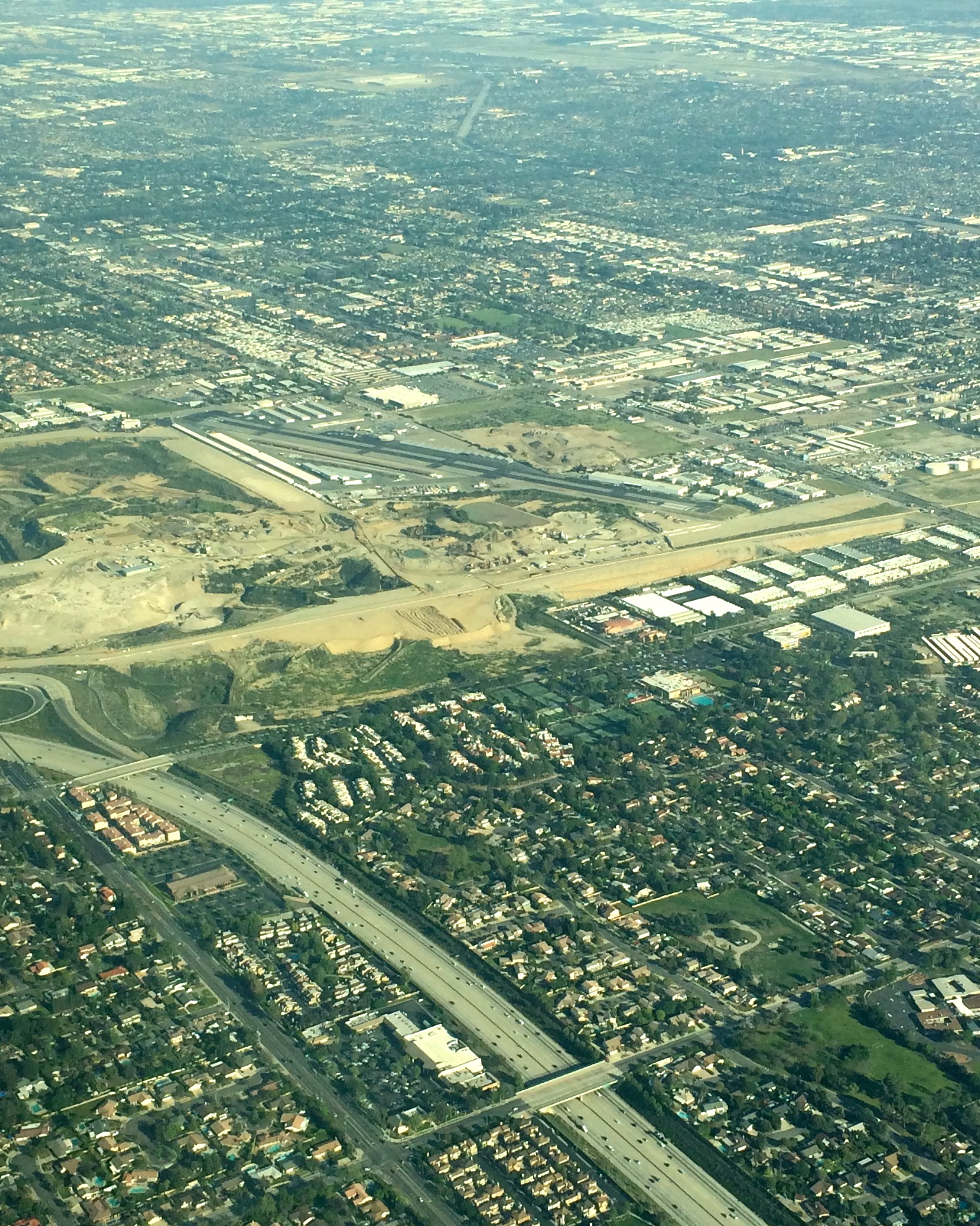
The I-15 N would not be a good emergency landing option:

At just the right time (about 10 miles out), SoCal invited me to switch to the SBD tower. I called in and was told to report when I was 2 miles NW of the midfield point and to expect a midfield crossover. I descended to pattern altitude and called in, at which point they told me to look for a Cessna taking off and to be sure that I crossed over behind it. I complied (the Cessna took off well before I got over the runway) and turned left downwind and landed. Oh wow, the SBD runway is HUUUGE! It’s so big (both long and wide) that you get this weird illusion as you’re landing that you’re just hanging motionless in space and you’ll never touch down. The runway looks MUCH closer than it is because it’s so big.
I was going a little too fast to get off at taxiway Alpha, so SBD told me to exit at Alpha2 – then to expedite because someone else was landing behind me. :) I complied and taxi’d back for takeoff (no separate ground controller). Originally I’d planned to continue on to Banning, but looking at the clock I realized that I only had 30 minutes left. I requested a straight-out departure to the west and was soon on my way back to EMT with flight following at 4500′ (thank you SoCal!). El Monte gave me a left base approach, which was mildly exciting because I was cleared #3 and #2 was turning right base in front of me. I kept a close eye on that plane as I came in! I then executed a picture-perfect short-field landing, about 10 feet past the threshold, and celebrated all the way to taxiway Delta.
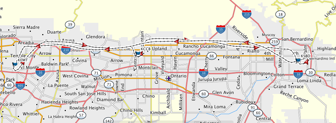
Here you can see my ground track, starting at EMT on the west and heading east to CCB and SBD, then back west to EMT (click to enlarge). Total flying time: 1.5 hours.
Lessons:
- Having all of the radio frequencies I would need (SoCal approach, tower, ground, and ATIS for each airport I visited) written in advance on my kneeboard made this a lot easier than otherwise and allowed me to focus much more on flying.
- I had taxiway diagrams for all of the airports with me, but didn’t use them. Still, I was glad to have them just in case!
- I wish I’d been able to get a picture of the SBD runway!
- Both SoCal controllers misheard my call sign initially. Either this plane’s radio is flaking out, or I need to enunciate better.
Looking forward to my next airport touring flight!