Lunar embroidery
July 31st, 2009 at 1:47 pm (Crafts, Planets)
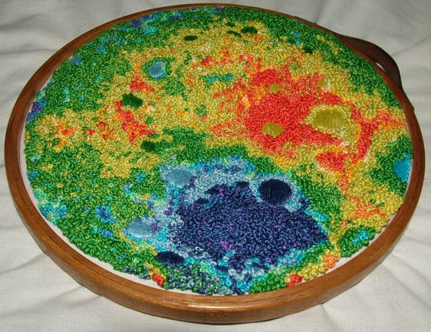
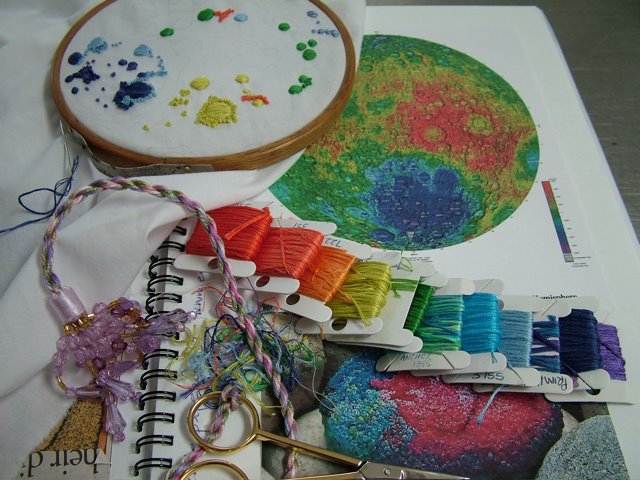 I’ve dabbled a little in cross-stitch embroidery, but never tackled anything this spectacular. beche-la-mer was so inspired by a topographical map of the Moon that she decided to embroider it, in full color and texture. After just one month’s effort, she achieved her goal.
You can read more about the process at her blog:
I think it’s awesome that she chose the far side of the Moon to immortalize.
(Thanks for the pointer, Jim!)
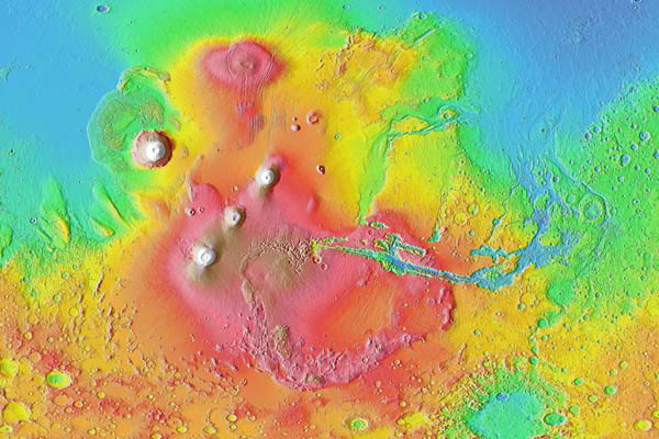
Jim suggests that a Mars follow-on would be another fun project. I think this image, showing the Tharsis bulge, Olympus Mons, and Valles Marineris, could make a particularly fine work of art:
But oh, all those French knots! Maybe I’ll finish the sock I’m knitting first.
Terran said,
August 1, 2009 at 6:58 am
Wow. That is some crazy stitching! How do you keep it all straight when the pattern is so detailed and fine-grained? I would imagine that when you’re making something “recognizable” (e.g., plants, animals, buildings), then you have a certain amount of guidance just based on familiarity with the shapes. But when you’re doing something like topo maps of other planets, the patterns are… More fractal-y? Less recognizable and every day? Dunno. In any case, they look (to my naive and thread-craft-free eye) harder than most other patterns. Do you end up having to do every stitch according to a pattern sheet?
Susan is in to knitting socks a bit recently — picked it up from an obsessed sock-knitter we met in London.
Also, the hemispheres of Mars pix are not showing up, at least on my browser. :-P
wkiri said,
August 1, 2009 at 10:13 am
Well, I’ve never done this sort of embroidery, just cross-stitch, where you’re working on fabric that has grids in it (Aida cloth) which matches a gridded pattern. But this person was working on regular cloth and, from her pictures, it almost looks like she was doing it free-hand, just using the picture for inspiration. But how would she get the scale right for the craters and their relative positions? To my eye, her end result is an excellent match to the topo map. I’d love to know more about her method, but didn’t see more detail on her blog.