Some friends invited me to go on an evening hike with the Sierra Club last week. It sounded like a nice way to get some exercise and get to catch up socially. Accordingly, I presented myself at the Griffith Park Merry-go-round parking lot at 6:45 for the 7 p.m. hike and waited for my friends to show up. At first, there were only a few people standing around, but gradually the influx increased until a sizable crowd of over 50 people had gathered. My friends arrived in the middle of the announcements by the local park rangers who warned us about (driving) speed limits and the presence of rattlesnakes. I was wondering what it would be like to go on a hike with nearly 100 people, when the local organizer (who noted that usually the attendance was 3-4 times larger, but the Lakers game had reduced it) began the number countdown.
“Hikes are rated in difficulty from 1 to 6, with 6 being the most strenuous. But don’t get us wrong, even a 1 is not a stroll in the park! If this is your first hike, do not attempt anything higher than a 3.”
My friends whispered, “We usually go on a 4 or 5. The 6 is usually a full-out run up and down the trails, often with rock climbing and bushwhacking involved. What would you feel comfortable with?”
This was a hike? I agreed to try the 4. The organizer was already shouting out numbers. “Here is So-n-so, and he will be leading the 6. Head out!”
Mr. 6 jogged away from the group, followed by a single person.
“Here is So-n-so-two, and he will be leading the 5. Head out!” A larger group of about 10 people peeled off to follow Mr. 5. It made sense, to have the faster groups start out first. Griffith Park contains a large network of (often steep) trails, and I would guess that the groups were picking different trails to attempt, but you certainly wouldn’t want to be the one accidentally holding up Mr. 6.
“Now, we have two leaders for the 4-hike… wait… this is a 4+! We don’t have a 4-hike tonight. And I see that it’s marked “4+, adventure!” You guys will all have a great time.” I was sucked away with the group of about 20 individuals willing to attempt the 4+. We were notified that two of the hikers were designated as “sweepers”; they were meant to stay at the back of the group and ensure that no one was left behind or collapsed or eaten by a mountain lion. The leaders: “If you find yourself getting behind the sweepers, this is not the hike for you!”
I think if I’d been there alone, I’d have been terrified.
Luckily, I had friends. As we started up the hill (not walking, no, we were marching up that hill), they wanted to hear about my recent trip to Japan. But pretty soon the pace was affecting our breathing and we settled into silence, focusing on putting one foot in front of the other, as we climbed a trail that the leaders called “Cardiac”. We reached the top (the faster hikers in our group were already there, doing push-ups) and had a short pause before ascending on “Carwash.”
“Why is it called Carwash?” I asked. My friends laughed. “I asked that, too, but I don’t want to spoil it for you,” one said. We turned off the level area and started up a slippery steep trail, where the name was quickly illustrated: it’s entirely overgrown with long bladed grass on each side, so as you clamber up, you get a continual brushing just like a carwash with spinning brushes. The grass often reaches above your head, so you end up climbing blindly upwards, fending off the grass with your arms, with the rattlesnake warnings resonating through your head.
We reached the top of one of the lower ridges and headed down the other side on “Toboggan Hill”, which was a trail deeply covered in powdery sand that was actually easier to slide down than to walk down. (Several of us ended up sliding whether we wanted to or not.)
Covered in dirt, we emerged onto a paved road and followed it for a quarter-mile. Except that the sweepers were catching up, so we ended up jogging down the road until the group stopped, searching for a trail with the somewhat alarming name of “Trapeze.” They couldn’t find it (there were mixed reactions to that), so we headed down a different trail, “Cactus.” Like everything else in this park, it was steep, and the sun was starting to set. We all kept an eye out for any cacti, but didn’t find any until the very bottom of the hill, where there was a huge parking-lot-sized patch of cacti on one side of the trail. “Good thing we didn’t hit this point after dark!” chuckled one hiker.
We ended up on a dirt road, and the leaders continued their search for “Trapeze”, which they thought might lead us back up and towards our starting point. It was 8:30 p.m. by then, and dusk was settling in. A trail was found, although no one strongly recognized it. We started up it, and it was a good thing that some generous and strong tree had decided to grow right on this trail, because its support for hand gripping was really the only way to get up the 60-degree slope. There was even one branch that went right across the trail, at head-height, which I thought could reasonably be labeled a trapeze, but the other hikers insisted that this was not The Trapeze, in a vaguely disappointed way. We got halfway up the hill when the trail dead-ended. After a few minutes of crackling and bushwhacking with their feet, the leaders gave up and directed us to head back down. There was a fork in the trail, but both sides went back down, so we opted to take the one we’d already come up. I could only see the barest outlines of dirt beneath my feet, and often went on all fours to scramble down the steep trail. Three of the group, including one leader, took the other fork and then regretted it: they ended up sliding out of control down the final 40 feet to the road, picking up scrapes and bruises. Not that we could see their injuries, as the only light at that point was a bit of city glow and the illumination of the half-moon.
The group decided to trek back on the dirt road, which at least could sort of be seen and trusted to be reasonably level. Except that the pace they set required jogging, not walking. By the time we got to the final trail back down to our cars (which was named “Anklebreaker”), I was getting a little disenchanted with the idea of this kind of hike. We didn’t reach the parking lot until about 9:40 (the hikes usually aim for two hours max), and while the leaders did wait at the bottom, the sweepers had given up their jobs about halfway through the hike, meandering wherever they liked through the group. It wasn’t clear what would be done if not all hikers made it back in the same group; would the leaders really have gone up the hill in the dark and tried to find them?
I also found the attitude towards light to be a bit odd. The regular hikers seemed almost proud of the hiking in the dark bit–they deliberately choose not to bring lights. While there was (sort of) enough light to follow the road, it struck me as excessively unsafe when climbing through the brush, especially for the leaders to not even have basic lights to check injuries.
Then again, I was warned not to try anything higher than a 3. :) Overall, it was in fact good exercise (I’m still feeling it in my legs, 2 days later), and I was glad that I’d managed to keep up and not keel over. I’m not sure I could really say that I enjoyed it, though. Maybe I should stick with Hike The Geek!
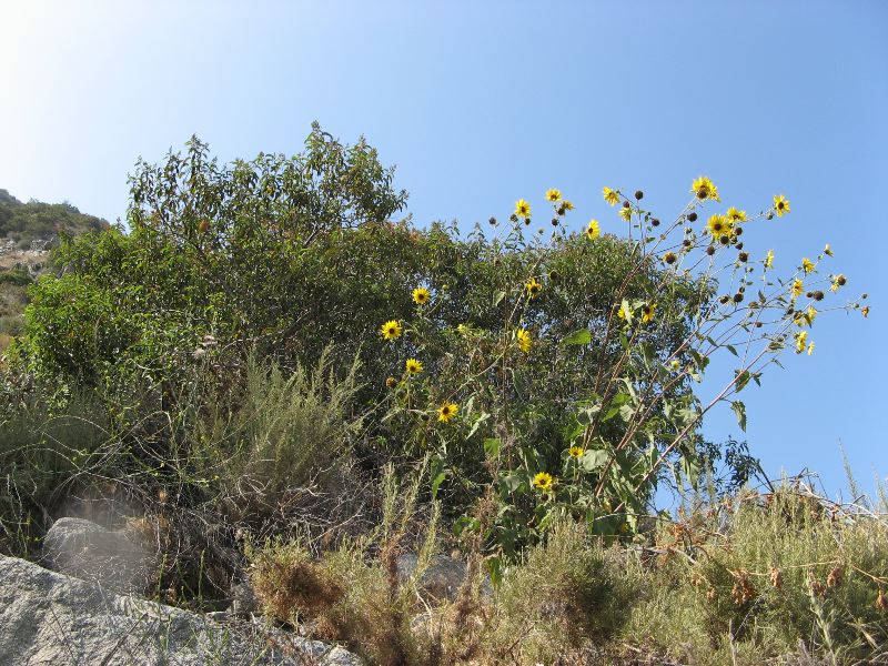 I started up the trail, which switchbacked up and up and up a rather steep hill. I began to be glad I’d started in the afternoon, because the trail was on the east side and therefore protected from the direct glare of the sun. I saw a lot of blooming flowers and thistles, and lizards were everywhere, affording lots of photo opportunities. Although there were a few other cars in the parking lot when I arrived, the trail itself was delightfully deserted. I climbed along in high spirits and, over a mile later, crested the hill. The trail then undulated over much greener and wetter terrain, resulting in a severely overgrown path. A few times I wasn’t sure I was still on the path, since I couldn’t see it, but I kept going as the grass and mustard bending over the path rose to my waist, then my elbows, then my shoulders. I pressed on and reached the top of the ridge, where the path parallels a fenceline, and then climbed past it to a view down into the next canyon west (Van Tassel Canyon). By that point the sun was starting to go down, and I’d had a good climb, so I let the waterfall go and headed back down.
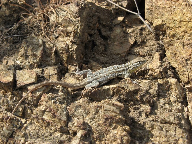 At home, I started poking around to figure out what trail I’d been on, and to learn more about its elusive waterfall. The background reading on this area is fascinating. It’s worth browsing the details, but as a quick summary it seems that originally there was a beautiful, shady, gentle path up Fish Canyon to the waterfall, which was enjoyed by many residents. Then Azusa Rock moved in and created a rock quarry that blocked the path to the waterfall. Instead, a new trail was blazed: up the mountain, along the crest, and then back down the same mountain, simply to avoid the quarry! The new trail has been criticized for being too steep, treacherous, full of poison oak, and badly maintained, to boot. Plus, it involves 3000 feet of elevation change, compared with the original path’s 900 feet. It is now also twice as long (10 miles round-trip instead of five). Good thing I turned back where I did (not even halfway there), and before running into any poison oak.