The elusive Fish Canyon waterfall
May 26th, 2009 at 10:38 pm (Nature, Politics)
All unknowing, on Monday I walked into a controversy that’s been raging since the 1980’s. I set out for a hike, and ended up driving over to Duarte and up a likely-looking road, then finding a trailhead marked “Fish Canyon.” There was no route map, but I was prepared with hat, water, snacks, and camera, and enjoyed the idea of striking out into the unknown. Plus, someone had signed the log book ahead of me and noted that they’d come for the waterfall — an excellent enticement!
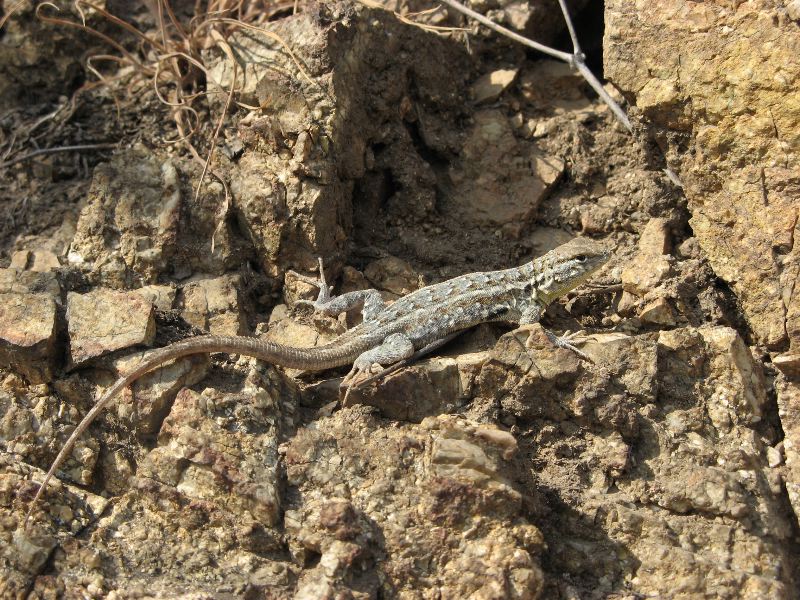
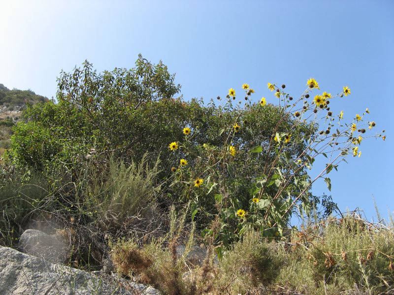 I started up the trail, which switchbacked up and up and up a rather steep hill. I began to be glad I’d started in the afternoon, because the trail was on the east side and therefore protected from the direct glare of the sun. I saw a lot of blooming flowers and thistles, and lizards were everywhere, affording lots of photo opportunities. Although there were a few other cars in the parking lot when I arrived, the trail itself was delightfully deserted. I climbed along in high spirits and, over a mile later, crested the hill. The trail then undulated over much greener and wetter terrain, resulting in a severely overgrown path. A few times I wasn’t sure I was still on the path, since I couldn’t see it, but I kept going as the grass and mustard bending over the path rose to my waist, then my elbows, then my shoulders. I pressed on and reached the top of the ridge, where the path parallels a fenceline, and then climbed past it to a view down into the next canyon west (Van Tassel Canyon). By that point the sun was starting to go down, and I’d had a good climb, so I let the waterfall go and headed back down.
 At home, I started poking around to figure out what trail I’d been on, and to learn more about its elusive waterfall. The background reading on this area is fascinating. It’s worth browsing the details, but as a quick summary it seems that originally there was a beautiful, shady, gentle path up Fish Canyon to the waterfall, which was enjoyed by many residents. Then Azusa Rock moved in and created a rock quarry that blocked the path to the waterfall. Instead, a new trail was blazed: up the mountain, along the crest, and then back down the same mountain, simply to avoid the quarry! The new trail has been criticized for being too steep, treacherous, full of poison oak, and badly maintained, to boot. Plus, it involves 3000 feet of elevation change, compared with the original path’s 900 feet. It is now also twice as long (10 miles round-trip instead of five). Good thing I turned back where I did (not even halfway there), and before running into any poison oak.
More research informed me that Vulcan Materials is now offering a shuttle service on some Saturdays to take hikers through the quarry and let them out on the other side, to hike the remaining 2 enjoyable miles to the waterfall. (This may be in response to the protests from locals over losing the original trail, which was starting to lead to trespassing, quarry equipment going missing, and grumblings over environmental impact of the query itself.) Here are all the details of the true hike to the waterfall, which is described in glowing terms. Contrast that with the same hiker’s description of the trail I actually hiked which includes the words “ridiculous,” “brutal,” and “absurd.” Of course, there was also much beauty. I’d like to see the waterfall itself someday — but shall I go shuttled (and likely crowded) or take the high, hard road?
Katie said,
May 27, 2009 at 10:43 pm
I have done it both ways (sneaking through the quarry, and up-up-up and over the switch backs). The falls are worth it, really – one of the highest in the San Gabriels. I think all the times we did that hike were before I had a digital camera, but I am sure I have photos somewhere. Good luck!