Maps at the Library of Congress
June 9th, 2026 at 1:45 pm (History)
Today I learned about the impressive collection of maps held by the Library of Congress, which has the largest map library in the world (6 million items). These items are publicly available to anyone with a (free) Library of Congress card, and there are also a lot of digital maps available online.
The Geography and Maps Division is currently featuring key maps from the American Revolution period (to commemorate the U.S.’s 250th anniversary). These 1,470 maps include a map of Philadelphia that includes a sketch of the State House where the Continental Congress met to hash out the Declaration of Independence, a Rochambeau map of the 1776 Battle of Long Island, the first map of the United States showing them as an independent country (1783), and more.

First map of the United States as an independent country (1783)
They also have an collection of Revolution era maps made accessible to visually impaired individuals. They have created “tactile maps” that reproduce maps with raised outlines, Braille labels, and textures, as well as audio descriptions of the maps. To make these tactile maps, they first choose maps likely to translate well to this form (ideally not too complicated), identify lines and edges, add Braille labels, then add texture to shade different regions. The maps are printed with a regular printer, on special paper, then heated and the places with ink swell into ridges you can feel. Awesome!
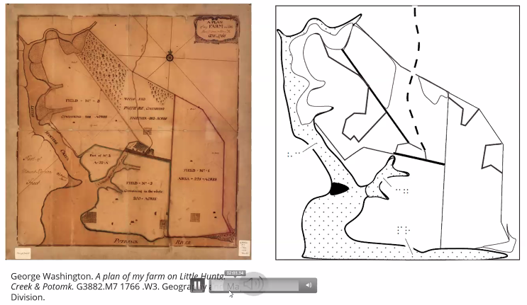
My screenshot of the tactile map example during the June 9 webinar
Finally, the “By the People” program at the Library of Congress, where you can volunteer to help transcribe handwritten materials, will soon be launching a project to transcribe nautical maps from the Atlantic Neptune Collection. It should show up at By the People when it opens. You can help enrich this collection!