EVA 11: Navigation | EVA 12: Rescue | EVA 13: Radio Ridge #1 | EVA 14: Olympus Mons
EVA 15: Caves #1 | EVA 16: Stratigraphy | EVA 17: Radio Ridge #2 | EVA 18: Radio Ridge #3
EVA 19: Valles Marineris | EVA 20: Caves #2
| Date | EVA | Description and details |
|---|---|---|
| 1-29-2010 | 11-12 | EVA 11 was a 2-person pedestrian EVA to test GPS navigation in white-out conditions. However, one crewmember had a simulated fall and required rescue. EVA 12 was mounted by 3 of the 4 remaining crewmembers to retrieve the injured crewmember using the newly constructed sled. • EVA 11 Report • EVA 12 Report • EveryTrail GPS track and photo slideshow • Garmin heartrate and elevation graphs 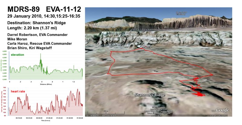
|
| 1-30-2010 | 13 | Brian and Luis ventured up on the ridge southwest of MDRS to find biological samples and survey the area for an upcoming seismic experiment. • EVA 13 Report • EveryTrail GPS track and photo slideshow • Garmin heartrate and elevation graphs 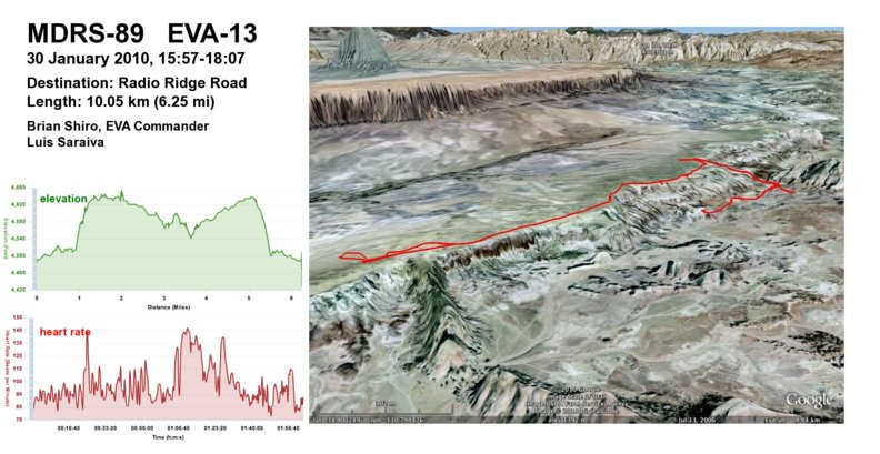
|
| 1-31-2010 | 14 | Darrel, Mike, Kiri, and Carla summited Olympus Mons for some breathtaking panoramic views. • EVA 14 Report • EveryTrail GPS track and photo slideshow • Garmin heartrate and elevation graphs 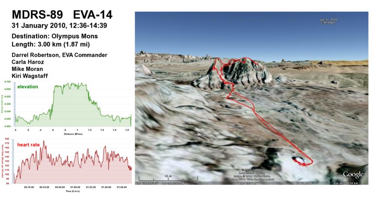
|
| 2-1-2010 | 15 | Luis and Mike roved across the landscape in search of a cave to collect biological samples. • EVA 15 Report • EveryTrail GPS track and photo slideshow • Garmin heartrate and elevation graphs 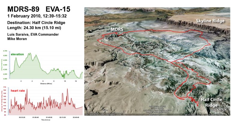
|
| 2-2-2010 | 16 | Kiri, Mike, and Carla measured a geologic section at the Lowell North Sedimentary Outcrop. • EVA 16 Report • EveryTrail GPS track and photo slideshow • Garmin heartrate and elevation graphs 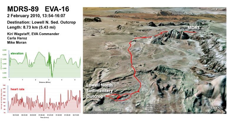
|
| 2-3-2010 | 17 | Brian, Luis, and Darrel began the seismic survey up on Radio Ridge. • EVA 17 Report • EveryTrail GPS track and photo slideshow • Garmin heartrate and elevation graphs 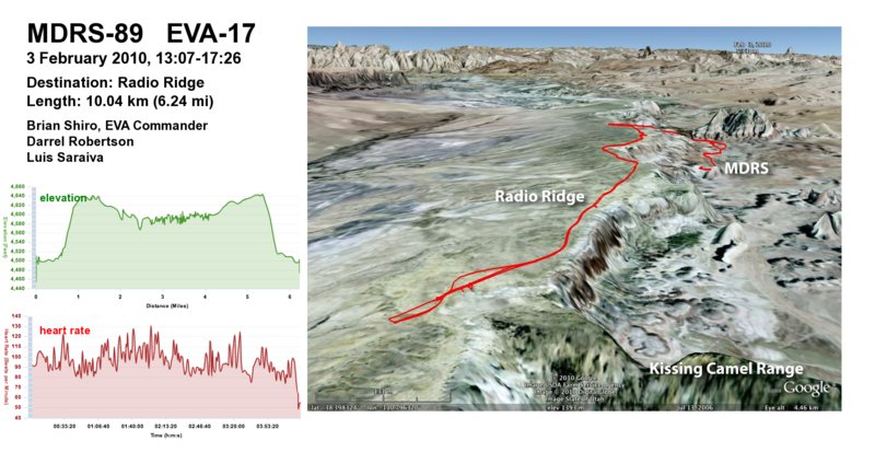
|
| 2-4-2010 | 18 | Brian, Luis, and Kiri returned to Radio Ridge to complete the 130-meter-long seismic profile. • EVA 18 Report • EveryTrail GPS track and photo slideshow • Garmin heartrate and elevation graphs 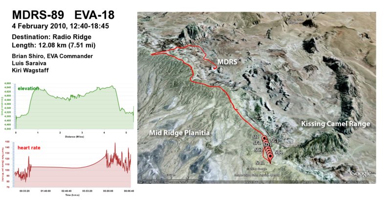
|
| 2-5-2010 | 19 | Kiri, Darrel, and Mike ventured into Valles Marineris and climbed Mount Sagewood. • EVA 19 Report • EveryTrail GPS track and photo slideshow • Garmin heartrate and elevation graphs 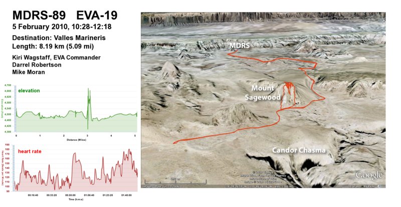 |
| 2-5-2010 | 20 | Luis, Carla, and Brian went on an extended rover EVA in search of caves. • EVA 20 Report • EveryTrail GPS track and photo slideshow • Garmin heartrate and elevation graphs 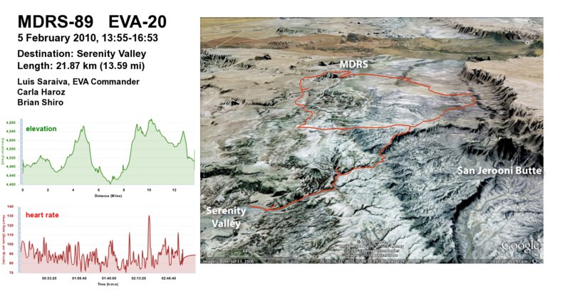
|
[…] ridiculous!) volumes of pictures and video we’d collected on the expedition. (You can view the full EVA information, including a map.) Culling through those photos to select the best ones for sharing was quite time-consuming! Also, […]
[…] View the EVA summary, map, elevation, and heartrate plots […]
[…] I during EVA 6, out onto the Mid-Ridge Planitia with LuÃs and Carla, and I took Opportunity during EVA 15 out to the northern canyon region with LuÃs. Both were relatively long EVAs, with number fifteen […]
[…] You can view the full EVA 16 information, including a map. […]
[…] our longest continuous time on the surface (though I’me pretty sure that my participation in EVA 15 still holds the distance record), and based on their brief post-excursion comments, things went […]
[…] You can view the full EVA 17 information, including a map. […]
[…] challenge, since Valles Marineris is positioned on the same Cactus Road that we failed to find on EVA 16. The road had been washed out so badly that, with patchy snowcover littering the terrain, I […]
[…] You can view the full EVA 18 information, including a map. […]