How to make chocolate

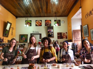
While in Guatemala, I took a class called the Bean to Bar workshop at the ChocoMuseo in Antigua. This two-hour delight really did go from how cacao grows – to how beans are extracted from the pods, dried, and roasted – to how the cacao nibs are removed, crushed, ground, mixed with other things, and aerated – to make what we call chocolate.

We learned that the ground cacao paste does not become “chocolate” until it is mixed with some sugar. So 100% dark chocolate doesn’t exist; it is 100% cacao :) (and nearly inedible, even for chocolate lovers!)

Quite possibly the most challenging step was when we each took a turn stirring and roasting the beans, which was when our friendly host asked each of us to tell us something about ourselves (in Spanish!). He got really excited about my job at JPL and wanted to know if we’d found life beyond the Earth :)


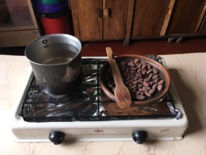
We roasted cacao beans, then split them open to get the nibs out.

Grinding was a frenzy accompanied by a group chant: “Choco, choco, la-la! Choco, choco, te-te! Choco-la, choco-te, choco-la-te!” Aerating the mixed chocolate by pouring it back and forth between two pottery carafes was also tricky to do without spilling!

We made two kinds of hot chocolate (drink): Mayan (cacao, water, chili, honey, and BLOOD) and European (cacao, milk, sugar, no blood). We used spices instead of blood :) and most agreed that the Mayan was more tasty than the European.

Next, we poured chocolate (I chose 70% dark) into individual molds and added flavorings as desired – I went for cinnamon, mint, cashews, ginger, orange slices; others chose cayenne, salt, gummy bears (?!), and other options I’ve forgotten. Mine turned out tasty, but SUPER intense, and sort of crumbly, possibly due to its dark level and lack of wax/gum/binders/whatever they put in store-bought chocolate.

We also made chocolate tea. It turns out that you can steep the cacao bean shells (from which the nibs were removed) in hot water and make a tea that tastes like a cross between coffee and tea :) I brought home some of this “tea” with a cinnamon flavor. Yum!

Volcanoes in Guatemala

I recently visited Guatemala as a volunteer with Librarians Without Borders. We first visited the city of Xela (also known as Quetzaltenango), which is colorful and vibrant. We toured the central market, the municipal building/palace (fascinating history), the lone public library, and other sights. One thing we did not get to visit up close is the massive volcano that looms over the town.

Santa María is a breathtaking sight whenever it deigns to be seen. (Much of the time it is shrouded in cloud.) It has been active for the past 30,000 years and last erupted in 2009. It had a dramatic eruption + earthquake in 1902 that was the third largest eruption of the 20th century that dropped volcanic ash as far away as San Francisco (!).

Xela is at 7600′ above sea level, and Santa María rises another 5000′ up!

Here’s what it looks like from Xela:

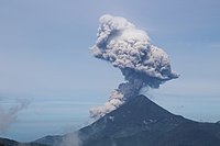
And here’s what the south (active) side can be like (per Wikipedia):

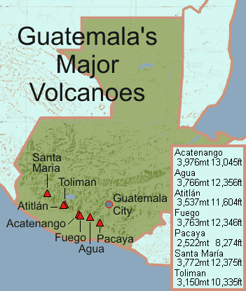
We then traveled on to Panajachel (a cute touristy town on the shore of Lake Atitlán), where there are three more huge volcanoes – Toliman, Atitlán, and San Pedro. And then on to Antigua, with its own collection (Volcán de Agua, Volcán de Fuego, and Acatenango). In all, Guatemala has 33 volcanoes. Ring of Fire indeed!

How to drive in New Zealand

Start by staying on the left. :)

I found some great resources to prepare for driving in New Zealand.

Check out this interactive driving video/game, which is a good chance to practice for any driver. It definitely tests your observation skills!

Some of the road signs that I found interesting or unusual are:

Speed limit sign indicating that there is “no restriction” so the national speed limit of 100 kph applies
One-lane bridge ahead. The little red arrow means that you do NOT have right of way but instead traffic from the other direction (big black arrow) does.

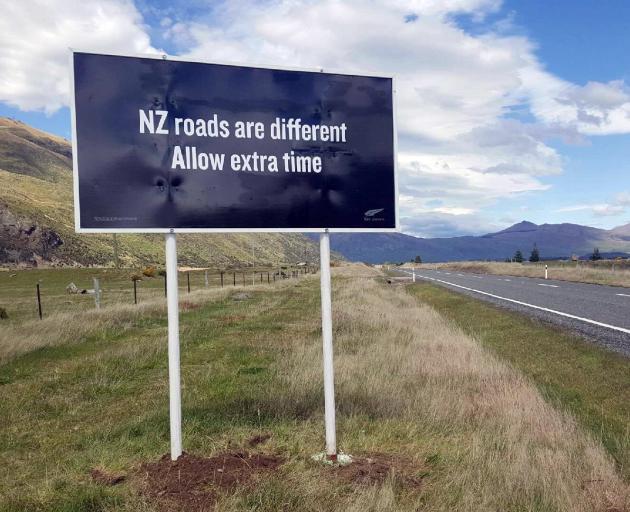
There are lots of warnings that it will take you longer to drive somewhere than you may expect. I saw this billboard a lot:

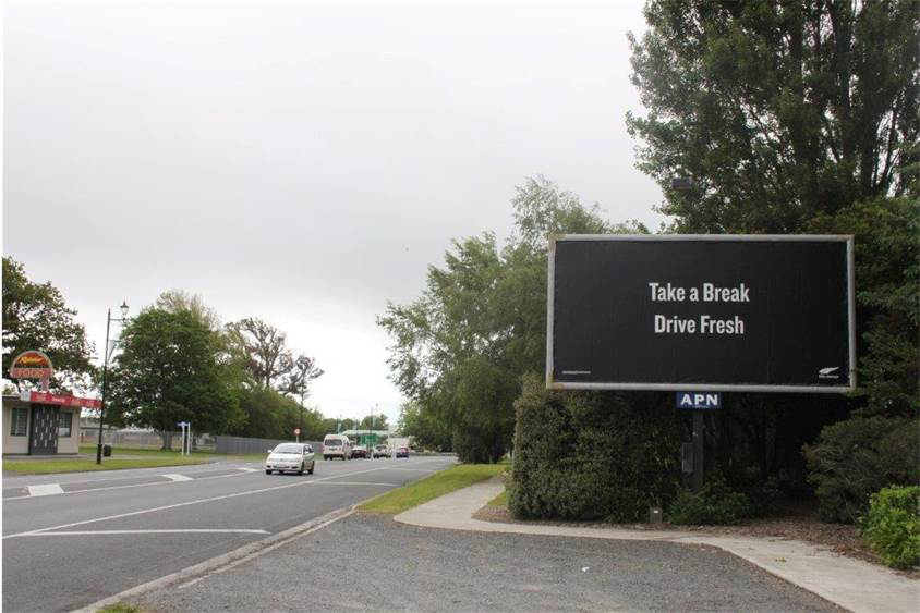
and this great reminder to take breaks:

One thing I wasn’t prepared for was the extensive construction going on everywhere I went, which certainly did make it take longer to get places. Many of the roads between cities were being resurfaced in various areas, so there was a lot of slow driving on gravel. In one place, there was a sign that we were driving on “wet concrete – wash car today” (!).

I also found that gas was much more expensive. Somewhat confusingly, prices are displayed in cents per liter (e.g., “199” instead of “$1.99”). I paid between $1.99 to $2.06 per liter, which works out to $7.50 to $7.80 per gallon (!). Giving how much driving I did, this ended up being a non-trivial part of my trip costs. An electric vehicle would make even more sense there :)

GPS navigation in airplane mode!

Recently on a trip to Ireland, in an effort to reduce my cellular data consumption, I put my phone into airplane mode while driving across the country. Imagine my surprise when, an hour later, I checked my phone and found that it was still correctly reporting my location, and giving me directions!

I scratched my head about this for a little while. The moving map was updating my position even in airplane mode! It was also scrolling the map as I moved. So it must be the case that

  1. Google Maps downloads and caches enough information that it can continue to show you the relevant map info even if it loses a data connection to its server, and
  2. The GPS receiver in the phone continues to operate in airplane mode.

This had never occurred to me! I was able to confirm it at other times during the trip. If you try to get directions from Google Maps when in airplane mode, it doesn’t work – you can’t search the maps. But if you get the directions started, then go into airplane mode (i.e., turn off cell data), then it will correctly continue to give you directions. However, if you deviate at all, it cannot re-route you, so you have to figure that out for yourself.

I decided to test this during a recent cross-country flight. Right before a flight from Los Angeles to Philadelphia, I got driving directions from Google maps (see right; it wants me to start on Sepulveda Blvd) and then I put the phone into airplane mode.

A few minutes after takeoff from LAX, we were out over the ocean and Google Maps was still urgently telling me to get onto Sepulveda Blvd:

I checked on the directions periodically throughout the 5-hour flight.

Each time we had made some more progress, but we were so far off the (road) track that Google Maps kept saying to go back to Sepulveda Blvd and start over.

As we got close to the Philadelphia airport, we were close enough to match up with a road (briefly) and the directions made more sense.

So cool! This means that even when an airplane doesn’t bother to give you that awesome moving-map track of where the plane currently is, you can still get it, IN AIRPLANE MODE, on your phone! (But only if you got some directions first.)

Flying to Rarotonga

The Rarotonga International Airport (RAR) has a runway that is 7,638 feet long.

I am flew there on a 777-200. That seems like a rather short runway for a big jet. I’ve landed on longer runways myself (like San Bernardino or Ontario). Curious, I looked up the minimum runway length for a 777-200. According to the Air Cyber Alliance, it is 8,563 feet. Yes, that is longer than the Rarontonga runway. Eeek?

Minimum runway lengths are dictated by how much space the plane needs to take off (which is generally longer than the space needed to land. Yes, this means planes can land somewhere and then be unable to take off again). The minimums are calculated for the aircraft when fully loaded, at max gross weight. So one way to take off in less distance is to reduce the load – fewer passengers, less cargo, or less fuel.

According to the seat map, my return flight is nearly or completely full of passengers, so they won’t go that route. And they can’t skimp much on fuel: the flight from RAR to LAX is quite long (4,688 miles, 10 hours) and the 777-200 has a maximum range of 5,240 miles when fully fueled. Plus, you don’t just take exactly enough fuel to get there; you need extra fuel in case you have to divert or circle or otherwise go out of your way. So maybe they just reduce cargo?

I noticed that they schedule return flights to depart close to local midnight – probably trying to use the coolest part of the day to improve the plane’s performance. And by “coolest”, I mean 78 F. Challenging for flying. I want to chat with these pilots!

Older entries »