
Today during our morning planning meeting, we discussed what our remaining goals for the mission would be. Our first week was a constant barrage of learning new procedures (for science investigations adapted to this environment; for keeping ourselves fed, watered, and clean; and for keeping the Hab functioning). Now that we’ve found our legs in those regards, our attention has opened out to thinking more broadly about what we want to accomplish. And now there are just four days left of our mission!
Brian has spent hours learning how his land streamer of seismic geophones works, so that he can deploy it to collect a seismic refraction profile of an intriguing inverted channel. Darrel has struggled to find time to work on his radio-controlled plane, which has a camera and could potentially be used for scouting good locations for on-foot investigations. Luis wants to culture and analyze the biological samples he’s already collected. Carla wants to compile the results of her Mars Dessert Research Station efforts. 😉 I’ve been itching to get out and do some real geology, not just the tourist-geology I’ve accomplished so far (point and gasp and take pictures!). Of us all, Mike may be in the best position, having raised the radio telescope from 10 feet to 20 feet high early in the mission; he’s been happily collecting data ever since.
After much discussion about what our remaining EVAs might focus on, Brian determined that his land streamer deployment likely would require a seriously long (like all day) EVA—or even two such EVAs. He also needed some more time to plan just where and how he would deploy it. So we decided that I would use today to do a two-ish-hour EVA with a geology goal, and Brian will aim to do a seismic EVA tomorrow.
I jumped on the chance immediately. I wanted to find an outcrop and practice measuring a stratigraphic column in Mars-like field conditions (e.g., suit, gloves, helmet, etc.). From our crew’s previous EVA 8 to Candor Chasma, it seemed a likely place to find nice exposed layers. That crew had walked out to the Chasma, but we instead planned to drive up Lowell Highway to Cactus Road, aiming for the “Candor Chasma Access Parking” area, to shorten the trip.
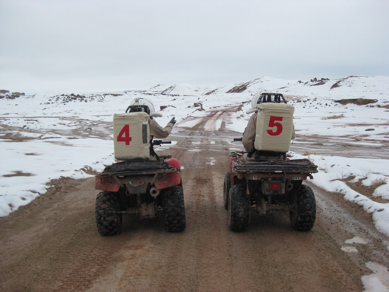
Kiri and Mike contemplate the road ahead
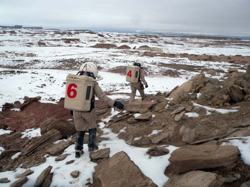
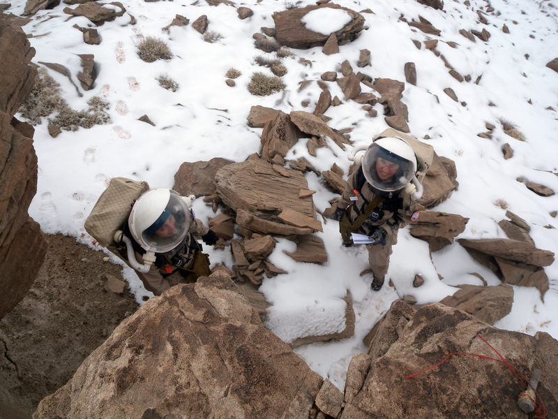
Carla and Kiri traversing the Lowell North Sedimentary Outcrop
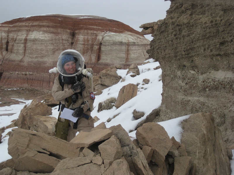
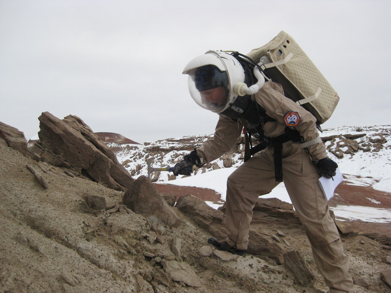
Kiri delights in the outcrop
 And then we lucked out! We spotted a low hill topped with some Dakota sandstone to the east of the road. (More accessible than the top of Olympus Mons, too!) We parked the ATVs and headed over on foot. And yes! It was fantastic! (Back at the Hab, we would learn that this site has a name: Lowell North Sedimentary Outcrop. So someone else thought it was worth study, too.)
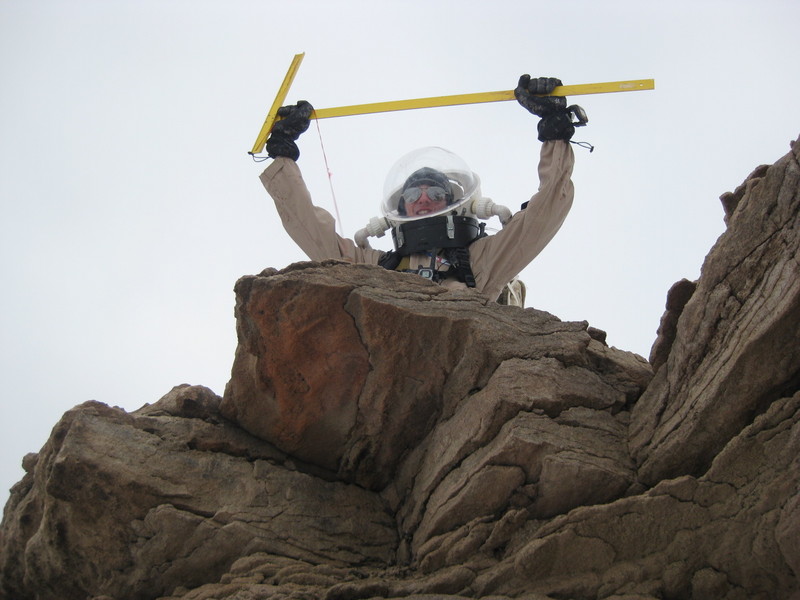
Mike doing his Star Wars sandpeople impersonation
Carla and Kiri sense a disturbance in the force
Kiri and the rock hammer
You can view the full EVA 16 information, including a map.
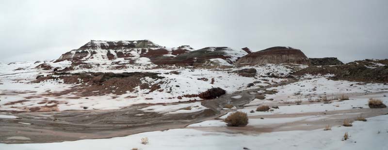
Olympus Mons from the northeast
We returned at 4:07 p.m. Now I’m sitting at the work bench, writing reports, and savoring having done some field geology, here at MDRS! I plan to make up a proper section (to scale, with composition, grading, and layering noted) soon… when I can find time. Whee!
We’re planning to play MDRS Clue tonight. Darrel turns out to have some truly impressive artistic skills, and he became enamored of the idea of an MDRS-themed Clue game. So he put together a full game board, with MDRS locations instead of the traditional Clue ones; a set of character cards, based on the six of us and our roles; and a set of weapon cards (hydrochloric acid, horribly polluted GreenHab water, oxygen tank, wrench, rock hammer, and a cool lookin’ rock). The end result is really cool! We’ll leave it here for future crews to enjoy. (See the board below. He drew all the locations from photos of the actual areas and they are very realistic!)

And with that, goodnight!
oh no you forgot to mention that the hydrochloric acid is a 37% solution!!! 😀
The devil is in the details! That 37% made this post! 😉 You guys are awesome, and I totally wish I were there with you all!
Wendy, you have no idea just how present you are. 🙂 Your name comes up on a daily basis! If only the webcams had microphones! 😉
I’m actually glad that the webcams don’t have sound, even if they weren’t just millisecond sound clips every three minutes. I don’t know who would want to hear us saying “nake” and “о мой бог” (I hope that’s right, Carla!) every few minutes…
… nake
SSSSSSSSSSSSSSSSSSSSSSS
The Clue board is awesome. 🙂
I suddenly realized I’m curious about the use of the term EVA. I know it’s a traditional space exploration term, but does the Hab really qualify as a vehicle? Wouldn’t EHA or something be more accurate?
Evan, we actually debated that exact question a few days ago! The Mars Direct scenario proposed by Robert Zubrin has the crew landing the spacecraft used to travel from Earth to Mars, and then using it as their habitat — which is a vehicle that no longer goes anywhere. So a crew might reasonably continue using EVA even after landing. However, there is disagreement amongst our crew about favorite terms for these expeditions. Darrel prefers “sortie” or “walkabout”, and Brian likes “field party.” 🙂 Nothing as concise as EVA has yet been proposed. Ideas?
Kiri
[…] planned to do the first seismic EVA yesterday, but I just wasn’t ready, so Kiri led the geology section EVA yesterday instead. Darrel, Luis, and Brian in the […]
Kiri,
EHA – replacing ‘vehicle’ with ‘habitat’ – is the only thing that immediately pops to mind.
Evan
I got a little behind on these posts…
I love the Clue game, that’s very creative.
And I’m thinking it would be a lot of fun to go on a hike with Kiri; her excitement over the geological finds sounds very infectious!
-bill
You’d *think* it would be fun! Instead I got made fun of by Mike and Darrel on these EVAs 😉 (in a good way, of course)
Kiri:
Well, you made fun of me for playing air guitar with the T-square, so we even out… I’m still filtering through SURF stuff, and I think I have it narrowed down to four right now. I’ll probably have a decision tonight or tomorrow.
Did you see the one on direct imaging of extrasolar planets? Cool!
Btw, if you’re at all interested, contact the mentors ASAP — they may already have picked students since there’s the proposal-writing process that has to be completed by the deadline, and even after they pick a student the opportunity still stays posted (so no way to know if they’re still looking). So (kind of deceptively) you don’t have until the deadline to make *your* decision. (But contacting them now isn’t a firm commitment, either, just a way to get your name under consideration.)
Kiri:
Yes, but unfortunately, like the other cool ones, it’s only for Caltech students…
Copy that. I think I have it narrowed to two:
3D Visualization of Solar Storm Propagation from the Sun to Earth
Time-Dependence of Saturn’s Atmosphere from Mid-Infrared Imaging
So unfair! Why do Caltech students get all the cool stuff? 🙂 The ones you cite also look interesting. Hey, if you learn IDL, you can do more SCRIPTING!