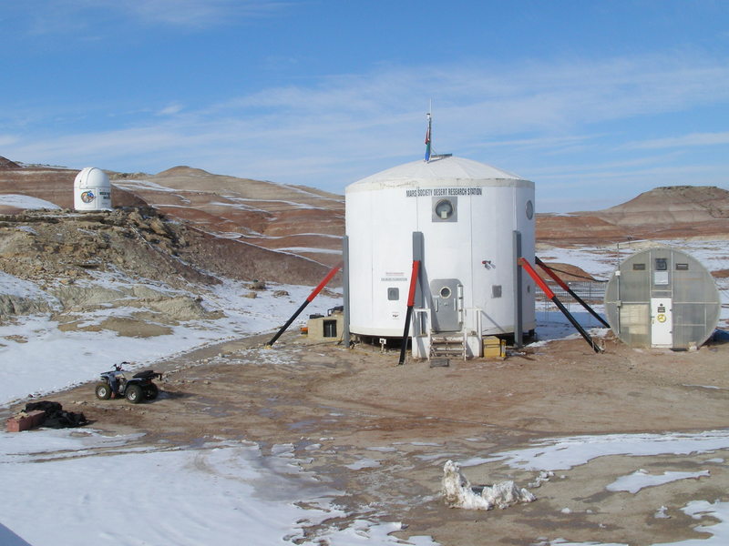
Hab Sweet Hab (in the sun)
I spent half of today up on Radio Ridge assisting with Brian’s seismic survey. He’d gone out yesterday with Luis and Darrel to start the survey, but they’d had their EVA truncated when the Panasonic Toughbook they were using fell off the ATV and yanked the Ethernet port entirely out of the PCMCIA card, rendering it inoperable. Worse, when they returned to the Hab, we discovered that none of the data they had collected had been saved to the hard drive! Brian handled this disappointment stoically, however, and planned a second attack for today. In yet another feat of gosh-wow on-the-fly problem solving, Darrel was able to solder the connections back together (!) and fix the PCMCIA card (I had been certain it was toast!). But then, to make things even easier, he donated his own laptop for use on the survey today. We took both laptops, just in case.
Brian knew from his EVA yesterday that this process would take some time, so he was itching to get going early. We all were. I’d volunteered to join the EVA out of curiosity (I’ve never studied any geophysics or seen seismic work in action) but also because Brian clearly needed some helpers. Luis and Darrel were worn out from yesterday, but Luis agreed to come along as well today—and ended up doing the lion’s share of the physical work in the expedition. But I’m getting ahead of myself. Although we were hoping for an early start, somehow it just took a long time to get everything together, strap all the equipment onto the ATVs, and get suited up. We didn’t enter the airlock until 12:30 p.m., and then Brian realized that in our rush he’d missed his helmet bungee cord… so we waited to re-pressurize, he got his helmet fixed, and then after a 5-minute wait we were finally stepping out into the noon sunshine. It struck us immediately, right in the face (our helmets don’t have visors).

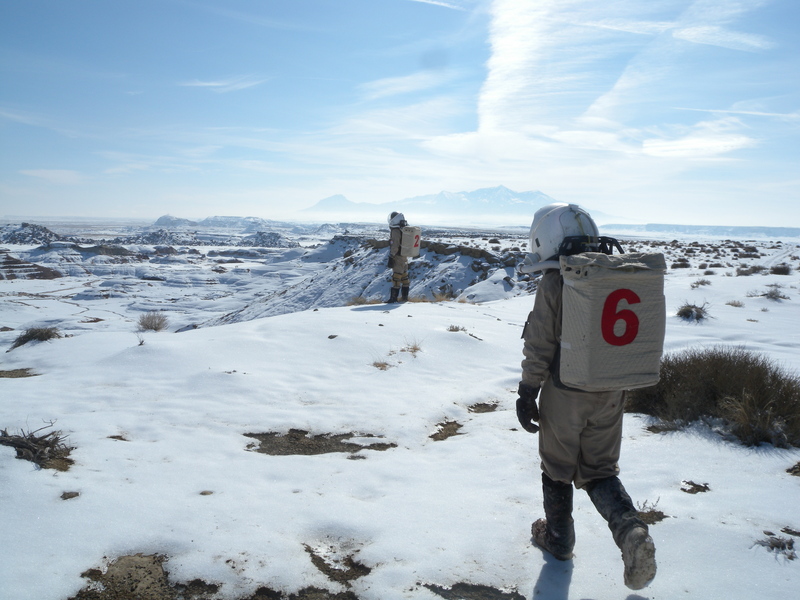
Setting off on EVA 18
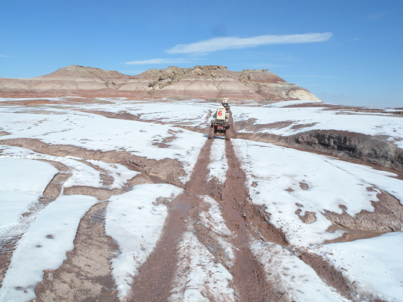
We saddled up, me taking Opportunity for the first time (I’ve always ridden Spirit previously). Opportunity is supposed to be the easiest to drive, because it’s the only one with a thumb-button gearshift (the others have foot-pedal clutches). But having gotten used to Spirit, it took me a while to get the hang of thumb-shifting. We took off across the desert, and my second lesson of the day struck. My previous ATV EVAs almost exclusively stayed on Lowell Highway. This time we were on a side trail—narrow, twisty, bumpy, and an entirely different riding experience! There were a few times that I thought to myself, “This is a ROAD?!” but there they were, twin tracks in front of me, leading the way. So I came up to a half-crouch and rocked with Opportunity, absorbing the jolts and bumps, standing up on the up-hill sections to lean forward and aid in the climb. It was more lively than the road drives—and I must say, a lot of fun! It’s funny how the ATV feels much more than a machine beneath you—more powerful, more animal, more alive.

Brian and Luis atop Radio Ridge
We came up onto Radio Ridge, and I gasped with delight and awe—the valleys and hills fell away from us to the right, in colored bands and dappled with sparkling, shining snow. I hadn’t seen the sun out in its full glory in days. It was shining and sparking off every rock and bush. Mid-ridge Planitia spread out before us to the west, all the way to Skyline Ridge in the distance (now THAT looks like fascinating geology). We headed south to the seismic survey site, and I was bouncing and revving along in utter delight. There was a drop-off to our left that plunged back down to where the Hab is situated, and we stopped several times along the way to snap pictures of the awesome panoramic view. Since I had the camera, Brian urged me to say the word if I wanted another picture stop. “Only if you think we have time,” I said, since our main goal was to collect the seismic data, and we were late off the mark. “We probably won’t want to do it on the way back,” he said, and boy, would he be proven right.
We reached the site and Brian hooked up the laptop to the land streamer (12 geophones strung on a 55-foot cable). That’s when it really hit home to me how much work yesterday’s crew had done. Although they hadn’t gotten any data, they’d done all the surveying and marked out a 300-foot line in 30-foot increments, enabling us to just walk to the appropriate point without having to check GPS coordinates or mark anything ourselves. (The distances are in feet, by the way, because the geophones are spaced at 5-foot intervals.) We could get straight to work.
Still, it took us a while to fall into a rhythm. The way this survey works is that you lay out the land streamer, pressing each of the geophones into the ground, and then position a heavy metal plate at key points; you then swing a heavy sledgehammer and smack the plate repeatedly (each such blow is a “shot”). The laptop records the response from each geophone for each shot, and after collecting data from six shot locations, you then connect the land streamer to an ATV and drag it 55 feet further along the line you wish to survey. We did this six times. Luis turned in a heroic effort with the sledgehammer, doing almost all of the more than 120 shots himself.
We also saw mountain lion tracks!
(Stay tuned for part two… WordPress won’t let me put it all in one post!)